Jasper National Park, in Alberta, Canada, is the largest national park within Alberta's Rocky Mountains, spanning 11,000 km2 (4,200 sq mi). It was established as Jasper Forest Park in 1907, renamed as a national park in 1930, and declared a UNESCO world heritage site in 1984. Its location is north of Banff National Park and west of Edmonton. The park contains the glaciers of the Columbia Icefield, springs, lakes, waterfalls and mountains.

The Canadian Rocky Mountain Parks World Heritage Site consists of seven contiguous parks including four national parks and three British Columbia provincial parks.

Mount Robson is the most prominent mountain in North America's Rocky Mountain range; it is also the highest point in the Canadian Rockies. The mountain is located entirely within Mount Robson Provincial Park of British Columbia, and is part of the Rainbow Range. Mount Robson is the second highest peak entirely in British Columbia, behind Mount Waddington in the Coast Range. The south face of Mount Robson is clearly visible from the Yellowhead Highway, and is commonly photographed along this route.

Mount Robson Provincial Park is a provincial park in the Canadian Rockies with an area of 2,249 km2. The park is located entirely within British Columbia, bordering Jasper National Park in Alberta. The B.C. legislature created the park in 1913, the same year as the first ascent of Mount Robson by a party led by Conrad Kain. It is the second oldest park in the provincial system. The park is named for Mount Robson, which has the highest point in the Canadian Rockies and is located entirely within the park.
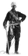
Conrad Kain was an Austrian mountain guide who guided extensively in Europe, Canada, and New Zealand, and was responsible for the first ascents of more than 60 routes in British Columbia. He is particularly known for pioneering climbs in the Purcell Mountains and the first ascents of Mount Robson (1913), Mount Louis (1916) and Bugaboo Spire (1916).

The Columbia Icefield is the largest ice field in North America's Rocky Mountains. Located within the Canadian Rocky Mountains astride the Continental Divide along the border of British Columbia and Alberta, Canada, the ice field lies partly in the northwestern tip of Banff National Park and partly in the southern end of Jasper National Park. It is about 325 square kilometres (125 sq mi) in area, 100 to 365 metres in depth and receives up to 7 metres (280 in) of snowfall per year.

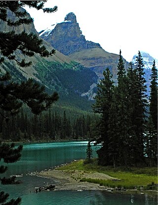
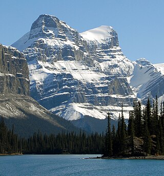
Maligne Lake is a lake in Jasper National Park, Alberta, Canada. The lake is famed for the colour of its azure water, the surrounding peaks, the three glaciers visible from the lake, and Spirit Island, a frequently and very famously photographed islet. The lake is located 44 km (27 mi) south of Jasper town, and is accessible by motor vehicle, including shuttle buses from Jasper. Boat tours run to Spirit Island in the spring to autumn season. The 44 km Skyline Trail, Jasper's most popular, highest and above treeline, multi-day hike, begins at Maligne Lake and finishes near the town of Jasper. Other popular day hikes include the Opal Hills and Bald Hills loops. Winter activities include cross-country skiing and snowboarding.

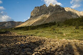
The Tonquin Valley is located in Jasper National Park, Alberta, Canada, next to the border of the provinces of Alberta and British Columbia, an area which is also the continental divide, running along the peaks of the South Jasper Range which rise above Amethyst Lake. Tonquin Creek drains Moat Lake and flows west into Mount Robson Provincial Park in British Columbia, and empties into the Fraser River. The Astoria River drains south and east into the Athabasca River.
The Skyline Trail is a hiking trail in Jasper National Park, Alberta, Canada. It is known for its views, with much of the hike being located above the tree line. It is also known for challenging weather conditions above the tree line, which can be a problem for hikers, who can lose sight of trails.

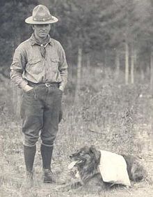
Mount Phillips is a mountain located on the border of Jasper National Park (Alberta) and Mount Robson Provincial Park. It is Alberta's 61st highest peak, and British Columbia's 84th highest peak. It was named in 1923 by J. Norman Collie after Donald "Curly" Phillips, a Jasper area outfitter and guide who made the disputed first ascent of Mount Robson in 1909.

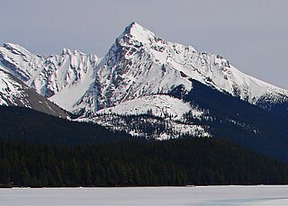
Mount Charlton is a 3,217-metre (10,554-foot) mountain summit located on the west side of Maligne Lake in Jasper National Park, in the Canadian Rockies of Alberta, Canada. Its nearest higher peak is Mount Unwin, 1.2 km (0.75 mi) to the west.
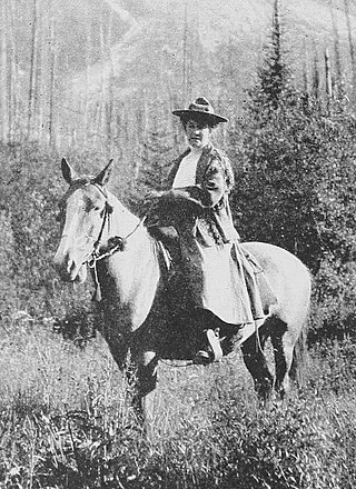
Mary Schäffer Warren (1861–1939) was an American-Canadian naturalist, illustrator, photographer, and writer. She was known for her experiences in the Canadian Rockies in the early 20th century.

Samson Peak is a 3,081-metre (10,108 ft) mountain summit located on the eastern shore of Maligne Lake in Jasper National Park, in the Canadian Rockies of Alberta, Canada. The nearest higher peak is Mount Charlton, 7.26 km (4.51 mi) to the east. Samson Peak is situated 1.72 km south of Leah Peak in the Queen Elizabeth Ranges.
Leah Peak is a 2,801-metre (9,190 ft) mountain summit located on the eastern shore of Maligne Lake in Jasper National Park, in the Canadian Rockies of Alberta, Canada. The nearest higher peak is Samson Peak, 1.72 km (1.07 mi) to the north.

Monkhead is a 3,250-metre (10,660-foot) mountain summit located at the south end of Maligne Lake in Jasper National Park, in the Canadian Rockies of Alberta, Canada. Monkhead was named by the Alpine Club of Canada for its hood-like appearance similar to a monk. Its nearest higher peak is Mount Warren, 2.3 kilometres to the south-southeast.
Mount Paul is a 2,850-metre (9,350 ft) mountain summit towering 1134 metres above the east shore of Maligne Lake in Jasper National Park, in the Canadian Rockies of Alberta, Canada. The nearest higher peak is Maligne Mountain, 1.81 km (1.12 mi) to the north-northwest. Mount Paul is situated north of Monkhead and they are often seen together in the background of iconic calendar photos of Spirit Island and Maligne Lake.
Mount Tekarra is a 2,694-metre (8,839-foot) mountain summit located in the Athabasca River valley of Jasper National Park, in the Canadian Rockies of Alberta, Canada. It is situated at the northwest end of the Maligne Range and is visible from Jasper and the Icefields Parkway. The nearest higher neighbor is The Watchtower, 7.0 km (4.3 mi) to the east.
Mount Warren is a 3,362-metre (11,030-foot) mountain summit located at the southeast end of Maligne Lake in Jasper National Park, in the Canadian Rockies of Alberta, Canada. Mount Warren is often seen in the background of iconic calendar photos of Spirit Island and Maligne Lake. The mountain rises 1,690 metres (5,540 ft) in less than 4 kilometres (2.5 mi) from the lake giving it dramatic local relief. Mount Warren is situated at the northwest edge of the Brazeau Icefield, and its nearest higher peak is Mount Brazeau, 2.26 kilometres to the southeast. Monkhead is a lower secondary summit to the northwest of the true summit.

Maligne Mountain is a 3,200-metre (10,500-foot) multi-peak massif located east of Maligne Lake in Jasper National Park, in the Canadian Rockies of Alberta, Canada. Maligne Mountain is surrounded by glaciers, and its nearest higher peak is Monkhead, 7.8 km (4.8 mi) to the south.

The Watchtower is a 2,791-metre (9,157 ft) mountain summit located in the Maligne River valley of Jasper National Park, in the Canadian Rockies of Alberta, Canada. It is situated in the Maligne Range and is visible from the Maligne Lake Road where it towers over Medicine Lake. Its nearest higher peak is Sirdar Mountain, 11.64 km (7.23 mi) to the north.